Friday Morning Update for Winter Weather Event 2/16-17/2024
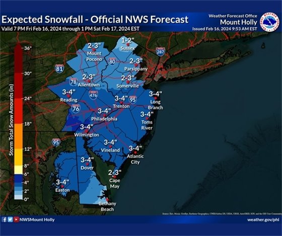
There has been a slight increase in forecast snowfall amounts in Queen Anne’s County as of this morning’s update. Confidence continues to increase for accumulating snowfall beginning late tonight and continuing through midmorning Saturday.
Key Takeaways:
• Snow showers will begin late tonight between 9 PM and midnight and become persistent through the predawn hours Saturday morning before tapering off midmorning Saturday.
• Total snowfall accumulations of 2-5 inches are now forecast for Queen Anne’s County.
• Ground temperatures are above freezing, which will help slow accumulations on surface-based roadways. However, air temperatures during the overnight and morning hours will support snowfall accumulations on elevated roadways. As a result, slick to snow-covered road conditions will be most likely be limited to elevated and untreated residential roadways with slushy road conditions expected on most surface-based primary roads.
• After the snow ends Saturday morning, air temperatures will rise above freezing and aid in natural melting throughout the day.
• Overnight temperatures in the mid-20s Saturday night into Sunday morning will support the refreezing of any residual moisture on roadways. This may result in a few icy patches before temperatures warm above freezing by midmorning Sunday.